Coming from the Old English *sc(e)alu, meaning ‘shallow’ and brōc meaning “brook or stream”. Sholebroke has been mentioned as early as “Shoulbrooke Land” in the parliament survey of 1650.

Sunsets over Sholebroke

Romance of Princess Amelia

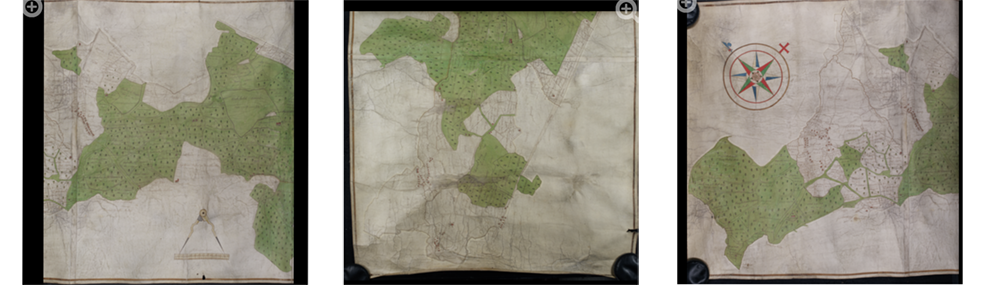
Old maps of the area

Phantasms of the living

Garden find

Rubio grand National Winner

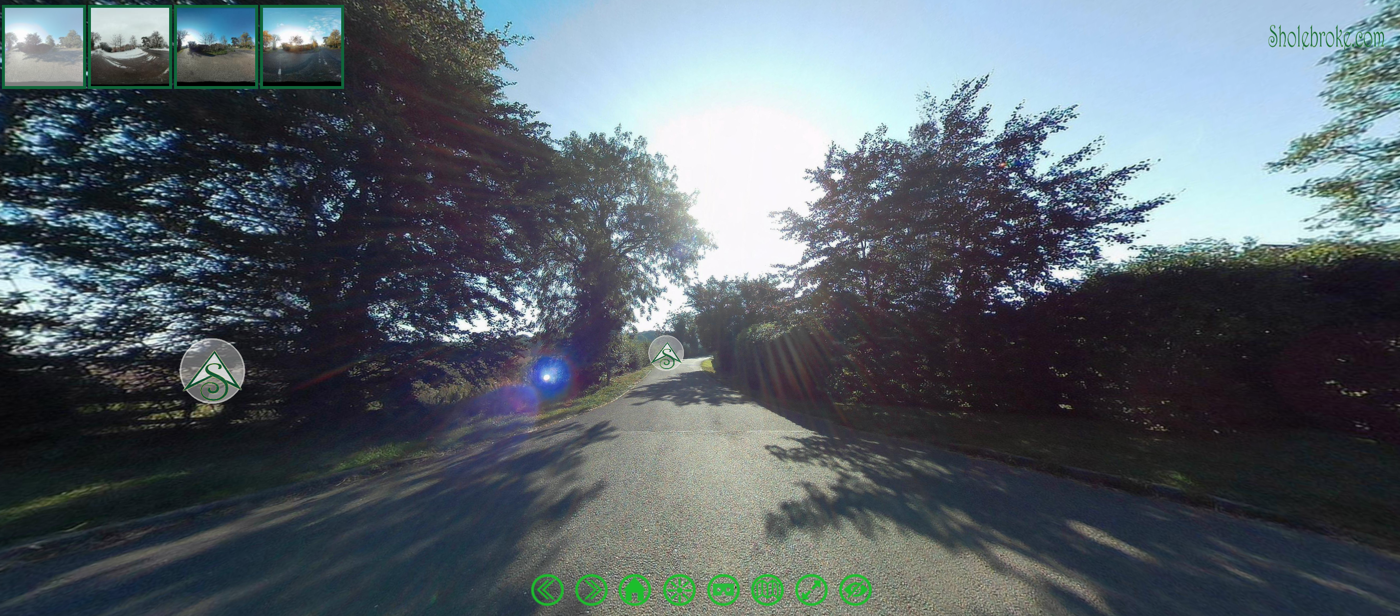
2019 Snow and then Bluebells !
In January 2019 we had a bit of snow and I thought it would be fun to capture Sholebroke and Black Pit Woods in the snow.
UPDATE: I then decided to also capture the Bluebells in April – Which were also very beautiful !!
UPDATE: I have now shot the area again during the beautiful August Bank Holiday Weekend. So the plan is now to do all 4 seasons – there is only autumn now to shoot.
UPDATE: I have now done Autumn and posted the 4 seasons tour.
Here is a virtual reality tour of the area. Click on the ![]() symbol to progress to the next view click and drag the image to look around each scene in 360 degrees. (Just like google maps) There is also a map to see all the locations of the tour. (click on the round buttons at the bottom of the screen)
symbol to progress to the next view click and drag the image to look around each scene in 360 degrees. (Just like google maps) There is also a map to see all the locations of the tour. (click on the round buttons at the bottom of the screen)
In each view you can see icons of the different seasons in the top left of the screen use these to switch between seasons. It is amazing to see the difference. There is a circular map button that allows you to see all the points and move quickly between them (click on the map border to close it)
This tour also works with a smart phone and VR headset. To use load website on phone and click on the headset icon choose your headset type.
To view the tour in full screen, on mobile or on VR headset click
here:
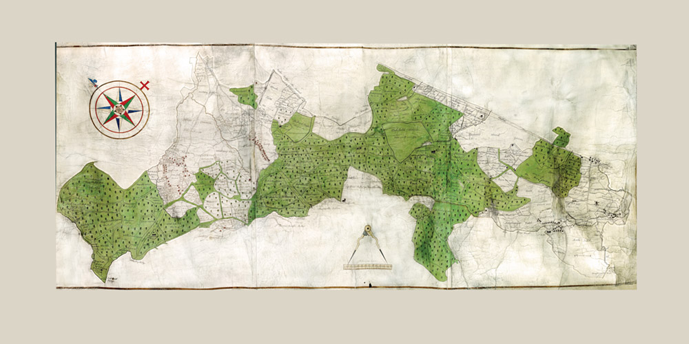
Whittlewood 1608 Map Project
During the Covid 19 lockdown I found a wonderful old map in the Northamptonshire archive (Map no 4210 if you are interested.) I decided that this would look great in my dining room on the wall so I paid for and downloaded the 3 image and spent quite some time converting a dull and barely legible map into a high resolution combined map with enough detail to blow up to 2meters wide.
I then got it printed out and mounted it on the wall.

I was very happy with the result and spent hours just looking around the map. I then had an idea to put the combined map online in a way that it couldn’t be downloaded easily – so I used my 360 virtual tour software to create an online interactive map. … Then I wondered if I could overlay the OS map. That was easier said than done as the original map was not on North South grid and was hand drawn and not “square” so it took lots of morphing of the OS Map to as closely match the 1608 map as I could. Unfortunately the hosting of the 360 map has broken. See page old maps of the area for some detail shots.